

Gordon Dam & Lake Gordon
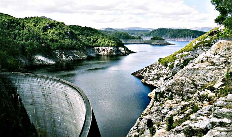
Lake Gordon is a man-made reservoir created by the Gordon Dam, located on the upper reaches of the Gordon River in the south-west region of Tasmania. The reservoir was formed in the early 1970s as a result of the dam construction by the Hydro-Electricity Commission of Tasmania in order to create an upper storage for the Gordon Power Station, the largest and most controversial hydro-electric power scheme in Tasmania.
Drawing from a catchment area of 1,280 square kilometres (490 sq mi), Lake Gordon is Tasmania's largest lake, with a surface area of 278 square kilometres (107 sq mi), with storage capacity of 12,359,040 megalitres (436,455.4�106 cu ft) or 12.5 km3 (3.0 cu mi) of water, the equivalent of twenty-five times the amount of water in Port Jackson. Lake Pedder is connected to Lake Gordon through the McPartlans Pass Canal.
Additional dams were proposed for the lower Gordon River, however they were subject to political protest led by The Wilderness Society, most notably the Franklin Dam controversy during the early 1980s. In 1983 the Hawke-led Australian Government intervened and overturned a decision by the Tasmanian Government to dam the lower Gordon. When the Tasmanian Government refused to halt work in the UNESCO-listed World Heritage Area, the Australian Government successfully sought a ruling in the High Court of Australia in Commonwealth v Tasmania. The lower Gordon was not dammed.
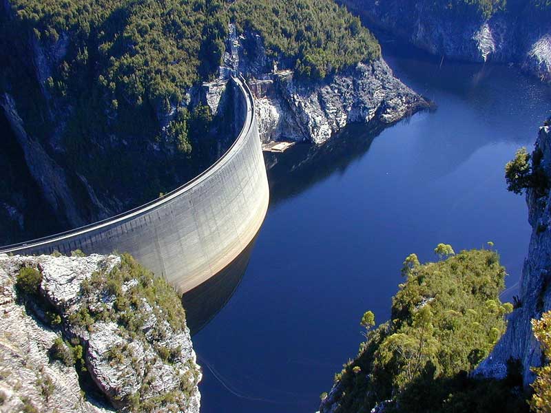
The Gordon Dam (also known as Gordon River Dam), is a double curvature arch dam on the Gordon River in Tasmania, Australia. The dam has a length of 192 m, and a height of 140 m, making it the tallest dam in Tasmania and the fifth-tallest in Australia.
Water from the dam drops 183 m underground into its power station, where three turbines of 144 MW generates up to 432 MW of power, covering about 13 per cent of the electricity demand of Tasmania. The first two turbines were commissioned in 1978, before the third was commissioned a decade later in 1988. The power station is fuelled by water from Lake Gordon. Water from Lake Pedder is also drawn into Lake Gordon through the McPartlans Pass Canal.
The Gordon Dam wall, constructed with 154 thousand cubic metres (5.4�106 cu ft) of concrete, is 198 metres (650 ft) long and 140 metres (460 ft) high, making it the tallest dam in Tasmania and the fifth-tallest in Australia.[ At 100 per cent capacity the dam wall holds back 12,359,040 megalitres (436,455�106 cu ft) of water; making Lake Gordon the largest lake in Australia.[4] The surface area of the lake is 27,800 hectares (69,000 acres) and the catchment area is 2,014 square kilometres (778 sq mi). The single controlled spillway is capable of discharging 175 cubic metres per second (6,200 cu ft/s).
Approximately 48 arch dams have been built in Australia and only nine have double curvature. Gordon Dam is almost twice the height of the next highest arch dam, Tumut Pondage.
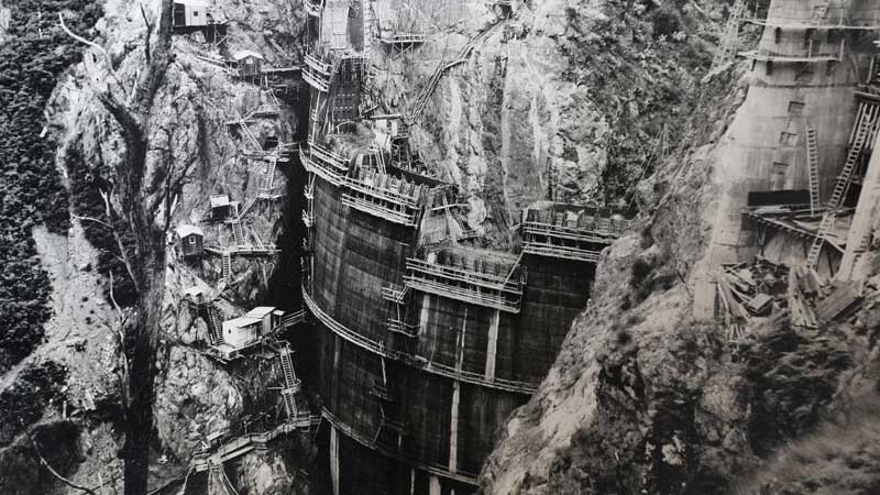
Gordon Dam wall and power station under construction, 1972
In 1963, the Australian Government provided an A$5 million grant to Tasmania's Hydro-Electric Commission to build the Gordon River Road from Maydena into the Gordon River area in the South West Wilderness region. Construction was underway by 1964, and within three years, the Tasmanian State Parliament approved the Gordon River Power Development with little in house opposition in 1967. Power operation began in 1978, a third generator was added in 1988.
The completed Gordon Dam was the only dam built on the Gordon River, despite the support of Tasmanian politicians such as Eric Reece, Robin Gray, and others to build the Franklin Dam further downstream. The construction of Gordon Dam resulted in some flooding of the connected Lake Pedder as planned. Subsequent opposition to restore Lake Pedder failed after a Parliamentary inquiry in 1995.
The dam was designed with Dr. Sergio Guidici as the chief engineer. He went on to be involved with the design of the Crotty Dam in the West Coast Range, one of the last significant dams created by Hydro Tasmania during its unabated dam-building era. The dam is connected with the Gordon River Power Station, 183 metres (600 ft) under the surface of the switch yard.
The village of Strathgordon was built in 1969 as a functional township of nearly 270 homes to house Hydro scheme builders and workers. At the peak of the Hydro scheme's construction there was a population of 2000. The village facilities included a complete shopping complex and a fully equipped school which had a peak enrolment of 230 students. A large heated indoor swimming pool was a feature of the school. Other village amenities included a church, police station, fire station, library and a well equipped sports centre. Staff were housed in a motel-style staff house and there were quarters for 640 single men with a central block containing a kitchen, mess and canteen. A mobile camp was established at Scotts Peak to accommodate 250 men.
In the year Strathgordon was built, it rained every day for six weeks over August and September and legend has it that when the sun eventually showed its bright face, the glare off the quartzite gravel of the area was so strong that the Hydro felt compelled to issue the village children with sunglasses for their outdoor playtime.
Strathgordon itself is 161km from Hobart. These days it is a far smaller community that it was when the dams were being built, its population is made up of mainly Hydro employees. Hydro Tasmania has developed the area for fishing, picnics, barbecues, camping and bushwalking.
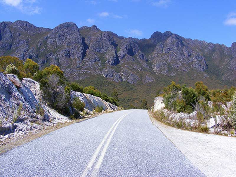
Gordon River Road commences just west of the township of Maydena and travels in a general westerly direction, passing the headwaters of the Florentine River (to the north) and the Weld River to the south at a location known as Tim Shea (altitude 952 metres), which looks north and north east to the Mount Field National Park. It then turns south, and at Frodsham's Pass, Scotts Peak Dam Road continues south to the eastern shores of the modified Lake Pedder, then to Edgar Dam, and finally to Scotts Peak Dam.
Construction of the road, which began in January 1964, was financed by a Commonwealth grant of $5 million to the State for development of the South-West area including the hydro-electric potential of the Gordon River, the timber resources, possible mineral resources and the tourist potential of this part of Tasmania.
Apart from anything else, this road gives travellers a rare chance to see one of the most pristine wilderness areas in the world. The scenery, regardless of the clouds that sometimes obscure the view, is positively magnificent, with snow-covered mountains ahead and to either side for much of the journey. Though it takes you into the Southwest National Park and alongside Lake Gordon and Lake Pedder, from the road you see only a tiny portion of the 500 square kilometres they expand over, and the untouched wilderness that surrounds them.
A permanent sign at the highest point of the Gordon River Road reports that the annual rainfall at that spot is 190 cm. It rains, literally, 300 days of the year in Strathgordon, the settlement at the end of the road.
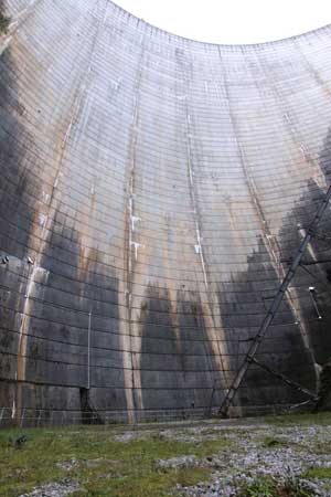
Gordon Dam from its base
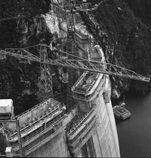
Gordon Dam construction